-40%
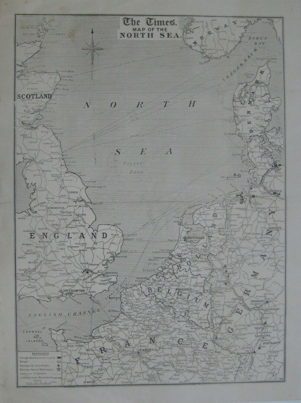
Original 1914 WWI Times War Atlas NORTH SEA MAP German Airship Sheds Forts Docks
$ 13.19
- Description
- Size Guide
Description
Original large-format 1914 map published in London byThe Times
: "Map of the North Sea."
The image area measures 56.5 x 42 cm [22¼" x 16½"].
The coverage area extends from Liverpool, England to Hanover, Germany, including London, Paris, Amsterdam, Brussels, Cologne, Frankfurt, Stuttgart, the Skagerrack, and the Kaiser Wilhelm Canal.
The legend key identifies large docks (dreadnoughts), small docks, German airship sheds, German naval fortresses, submarine telegraph lines, and international boundaries.
Condition:
This map is in very good condition, bright and clean, with
no
marks, rips, or tears. It has a horizontal center fold, as issued, and it is blank on the back, with no printing on the reverse side. Please see the scans and feel free to ask any questions.
It was one of ten maps published in
The Times War Atlas
, London, 1914-1915. It had been disbound from the atlas many years ago, and tiny pinholes in the upper corners suggest that someone had hung it on a wall during the First World War.
Buy with confidence! We are always happy to combine shipping on the purchase of multiple items — just make sure to pay for everything at one time, not individually.
Powered by SixBit's eCommerce Solution
